
History
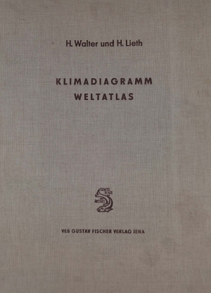
The CLIMAP electronic world atlas of climate diagrams is modeled after the Klimadiagramm-Weltatlas (World Atlas of Climate Diagrams) compiled by Heinrich Walter and Helmut Leith and published in three deliveries (Lieferung) in 1960, 1964, and 1967 by VEB Gustav Fischer Verlag Jena (Germany). A further discussion of the climate diagram and its uses were provided by Walter in German (Walter, 1970), and in an English volume that included a series of large-format paper maps (Walter et al., 1975) that contained a selection of the 9000 climate diagrams published in the original atlas.
Professor Dr. Heinrich Walter (1898-1989), was the director of the Botanical Institute of the Agricultural College at Stuttgart-Hohenheim (Botanischen Institutes der Landwirtschaftlichen Hochschule Stuttgart-Hohenheim), Professor Dr. Helmut Leith (1925-2015) was at the Department of Botany at the University of Hawaii Honolulu. In preparing the Klimadiagramm-Weltatlas they were assisted by Dr. Helmut Rehder and Dr. Elisabeth Harnickell.
Norman Perry, in his review of the atlas in 1968 (Perry, 1968), wrote
The appearance of the 2nd and 3rd deliveries of maps for the Klimadiagramm Weltatlas completes this massive venture, and the project can now be reviewed as a whole. The impetus came originally from a desire to delimit more accurate climatic regions as a basis for vegetation studies, and to utilize on a uniform basis the vast amount of meteorological data available in the world. The complex ‘Klimadiagramm’ was evolved as the means of ordering the information. Each diagram is for a single station and contains information on mean values of temperature and precipitation, extreme values of these phenomena and the range of temperature. Where appropriate, frost conditions are indicated. Each station is located by its name, altitude and the number of years over which observations are available. On the basis of these diagrams, the authors recognized ten broad climatic regions with subdivisions to replace the, in their view, unsatisfactory Köppen scheme. The Atlas consists of sheets containing the diagrams for all the stations used in the studies. These are accompanied by maps delimiting the climatic regions and giving the diagrams considered to be representative of the region. The validity of the regions as delimited and the adequacy of the data portrayed are questions with which specialist climatologists will occupy themselves. The present reviewer can but note the care which has been put into the production of this atlas, the provision of glossaries in five languages, and the usefulness to the geographer of having comparable data for different areas of the world.
In scientific research, the Klimadiagramm-Weltatlas has been long superseded by gridded climatological datasets produced using modern computers, first through the efforts of Rik Leemans and Wolfgang Cramer, working at IIASA in the late 1980's (Leemans & Cramer, 1991), and later by the Climatic Research Unit of the University of East Anglia (New et al., 2002), and through other efforts (Hijmans et al., 2005; Fick & Hijmans, 2017; Karger et al., 2017). These datasets start with much of the same ground-based weather station data that Walter and Leith compiled, but then they create continuous fields of meteorological variables using topography and other ancillary variables as covariate or driving variables. Nevertheless, examination of climate data at an individual weather station is still a valuable pursuit.
References
Fick, S. E., & Hijmans, R. J. (2017). WorldClim 2: new 1-km spatial resolution climate surfaces for global land areas. Int J Climatol, 37(12), 4302-4315. doi:10.1002/joc.5086
Hijmans, R. J., Cameron, S. E., Parra, J. L., Jones, P. G., & Jarvis, A. (2005). Very high resolution interpolated climate surfaces for global land areas. Int J Climatol, 25(15), 1965-1978. doi:10.1002/joc.1276
Karger, D. N., Conrad, O., Bohner, J., Kawohl, T., Kreft, H., Soria-Auza, R. W., Zimmermann, N. E., Linder, H. P., & Kessler, M. (2017). Climatologies at high resolution for the earth's land surface areas. Sci Data, 4, 170122. doi:10.1038/sdata.2017.122
Leemans, R., & Cramer, W. P. (1991). The IIASA Database for Mean Monthly Values of Temperature, Precipitation, and Cloudiness on a Global Terrestrial Grid. Laxenburg, Austria: International Institute for Applied Systems Analysis.
New, M., Lister, D., Hulme, M., & Makin, I. (2002). A high-resolution data set of surface climate over global land areas. Climate Research, 21(1), 1-25. doi:10.3354/cr021001
Perry, N. (1968). Cartographical Survey: Klimadiagramm Weltatlas by H. Walter, H. Lieth and Elizabeth Harnickel. The Geographical Journal, 134(1), 156-157.
Walter, H. (1970). Ergänzende Betrachtungen zu der im Klimadiagramm-Weltatlas Verwendeten Klimadarstellung. Erdkunde, 24(2), 145-149.
Walter, H., Harnickell, E., & Mueller-Dombois, D. (1975). Climate-diagram Maps of the Individual Continents and the Ecological Climatic Regions of the Earth: Supplement to the Vegetation Monographs. Berlin Heidelberg New York: Springer-Verlag.